Summary
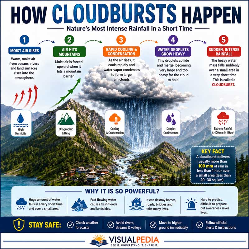
A cloudburst is an extremely intense rainfall event that occurs when moisture-laden air rises, cools, and releases large amounts of water over a small area. Common in mountainous regions, cloudbursts can trigger flash floods, landslides, and severe environmental damage.
DOWNLOAD PDF
Introduction
Heavy rainfall is a common weather phenomenon, but sometimes nature produces an event so intense and concentrated that it overwhelms everything in its path within minutes. This phenomenon is known as a cloudburst.
Many people search for answers to questions such as what is cloudburst and how does it occur, what causes cloudburst, and how dangerous is a cloudburst, especially after devastating incidents in mountainous regions such as Himachal Pradesh and Uttarakhand.
A cloudburst is not simply heavy rain. It is an extremely intense rainfall event that occurs over a very small geographical area and usually lasts for a short period. The sudden release of a massive amount of water can trigger flash floods, landslides, road collapses, and widespread destruction.
India experiences cloudbursts regularly, particularly in the Himalayan region. Understanding what are cloudburst and how do they occur is essential because these events can affect both mountain communities and tourists.
This article provides detailed information about cloudburst, including its causes, formation, characteristics, dangers, and safety measures.
What Is Cloudburst?
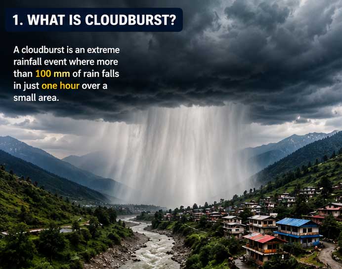
Before discussing what is cloudburst and how it happens, let’s understand its basic definition.
A cloudburst is an extreme weather event characterized by very heavy rainfall over a localized area within a short period. Meteorologists generally classify rainfall as a cloudburst when an area receives approximately 100 millimeters (10 centimeters) or more of rain within one hour.
Many people ask, what does cloudburst meaning actually refer to?
The term “cloudburst” creates the impression that a cloud suddenly bursts like a balloon. Scientifically, clouds do not literally explode. Instead, atmospheric conditions cause a massive amount of water vapor to condense rapidly and fall as intense rainfall.
Cloudburst: How Much Rain Falls?
One of the most common questions is cloudburst how much rain actually occurs during such an event.
Typically:
- Rainfall exceeds 100 mm within an hour.
- In some cases, rainfall may be much higher.
- The rain is usually concentrated within an area of less than 20-30 square kilometers.
People also search for how much rainfall in cloudburst, how much water in cloudburst, and how much water is in a cloudburst.
To understand the scale, imagine 100 liters of water falling on every square meter of land within one hour. Now multiply that by thousands of square meters. This explains why cloudbursts can quickly transform small streams into raging rivers.
How Does a Cloudburst Happen?
The most frequently searched question is how does a cloudburst happen.
Several atmospheric processes occur simultaneously.
1. Warm Air Rises
Warm air near the Earth’s surface rises into the atmosphere. This air contains a large amount of water vapor.
2. Moisture Accumulates
As the air rises, it cools. The water vapor begins condensing into tiny water droplets that form clouds.
3. Mountains Force Air Upward
Mountain ranges play a crucial role. As moisture-laden winds encounter mountains, they are forced to rise even higher.
4. Rapid Condensation Occurs
Cooling causes additional condensation. Large amounts of water accumulate inside the cloud.
5. Rainfall Is Released Suddenly
Eventually, the atmosphere can no longer support the accumulated water. The cloud releases enormous amounts of rainfall over a very limited area.
This process explains how a cloudburst occurs, how cloudburst happens, and cloudburst how does it happen.
How Cloudbursts Are Formed
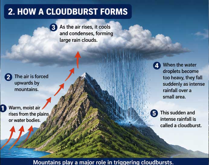
Many readers ask how cloudburst are formed, how cloudburst form, and how is cloudburst formed.
Cloudbursts usually develop through a process called orographic lifting.
When moisture-rich winds move toward mountain slopes:
- Air rises.
- Temperature decreases.
- Condensation increases.
- Water droplets combine.
- Heavy precipitation develops.
This is the primary reason cloudbursts frequently occur in mountainous regions.
Scientists studying how cloudburst is formed have discovered that unstable atmospheric conditions combined with high humidity create the ideal environment for these events.
What Causes Cloudburst?
Another common question is what causes cloudburst.
Several factors contribute to cloudburst formation:
High Humidity
Air containing excessive moisture provides the raw material necessary for intense rainfall.
Mountain Topography
Mountains force air upward, accelerating condensation.
Atmospheric Instability
Temperature differences between atmospheric layers increase vertical air movement.
Monsoon Systems
In India, monsoon winds transport vast quantities of moisture from the Arabian Sea and the Bay of Bengal.
Climate Change
Scientists believe rising temperatures are increasing atmospheric moisture, potentially contributing to more extreme rainfall events.
If you’re wondering how can cloud burst or how cloud burst will happen, the answer lies in the interaction between moisture, topography, and atmospheric instability.
How Does a Cloudburst Look?
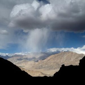
Many people search online for how cloudburst look like, how does a cloudburst look like, what does a cloudburst look like, and how does cloudburst look like.
A cloudburst may appear as:
- A dark, dense cloud over a specific location.
- An intensely concentrated rain curtain.
- Rainfall so heavy that visibility drops to nearly zero.
- Water cascading down hillsides within minutes.
Unlike widespread rainfall, a cloudburst affects only a small area while neighboring regions may remain relatively dry.
Those looking for how does a cloudburst look should imagine a localized waterfall descending from the sky.
People often search for how cloudburst happens video and how cloudburst video to visualize these events because photographs often fail to capture their intensity.
How Do Cloudbursts Differ From Regular Rainfall?
Many people ask how do cloudburst differ from regular rainfall and how is cloudburst different from rain.
| Cloudburst | Regular Rainfall |
|---|---|
| Extremely intense | Usually moderate |
| Localized | Covers larger areas |
| Short duration | Can last several hours |
| Causes flash floods | Usually less destructive |
| Common in mountains | Occurs almost everywhere |
Understanding how does cloudburst work helps explain why cloudbursts are far more dangerous than ordinary rainstorms.
How Long Does a Cloudburst Last?
Another frequently asked question is how long does a cloudburst last.
Most cloudbursts last:
- 15-30 minutes.
- Up to one hour.
- Occasionally longer under exceptional atmospheric conditions.
Despite their short duration, cloudbursts can cause catastrophic damage.
How Dangerous Is a Cloudburst?
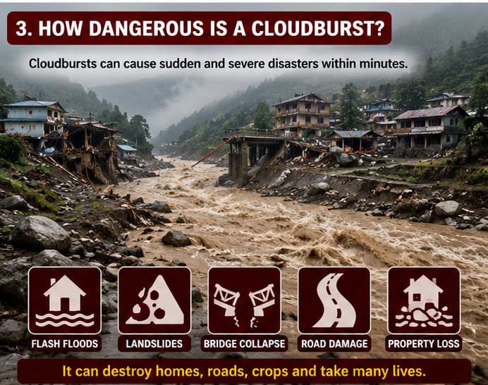
Questions such as how dangerous is cloudburst and how dangerous is a cloudburst are becoming increasingly common.
Cloudbursts are extremely dangerous because they can trigger:
- Flash floods.
- Landslides.
- Mudslides.
- Bridge collapses.
- Road washouts.
- Building damage.
Mountain valleys are particularly vulnerable because water rapidly flows downhill, carrying rocks, trees, and debris.
Can a Cloudburst Kill You?
Unfortunately, the answer is yes.
Many people ask, can a cloudburst kill you.
A cloudburst itself may not directly cause fatalities, but the resulting disasters can be deadly.
People may become trapped by:
- Flash floods.
- Landslides.
- Collapsing structures.
- Rising rivers.
The danger increases dramatically when people are traveling through mountainous regions during the monsoon season.
How Often Do Cloudbursts Happen?
Another common question is how often do cloudburst happen.
Cloudbursts are relatively rare compared to ordinary rainfall. However, they occur regularly in:
- The Himalayas.
- The Western Ghats.
- High-altitude regions.
Researchers continue to monitor changing weather patterns to understand whether climate change is increasing their frequency.
Cloudbursts in India
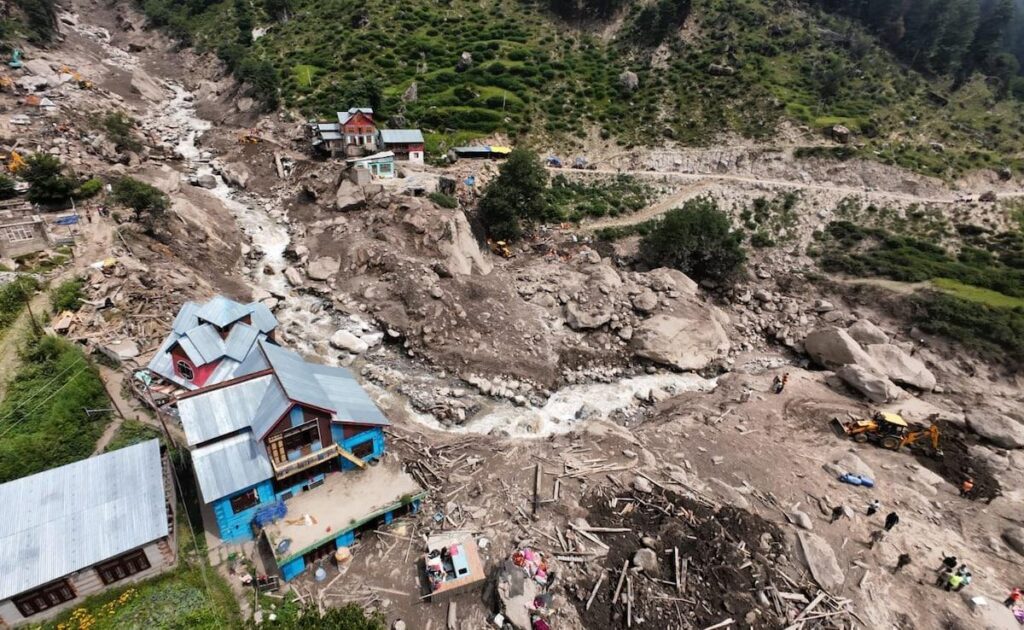
India experiences numerous cloudbursts every year.
People often ask:
- How many cloudburst happened in India?
- How many cloudburst in India?
- How many cloudburst in India 2025?
The exact number varies from year to year because some localized events go unreported.
States that experience frequent cloudbursts include:
- Uttarakhand.
- Himachal Pradesh.
- Jammu and Kashmir.
- Ladakh.
People also search for how many cloudburst in Himachal Pradesh and how many cloudburst in Uttarakhand because these states are especially vulnerable.
Uttarakhand and Uttarkashi Cloudbursts
Several devastating cloudbursts have occurred in Uttarakhand.
Searches such as how many people died in Uttarakhand cloudburst, how many people died in Uttarkashi cloudburst, and how many died in Uttarkashi cloudburst usually increase after major disasters.
Similarly, searches for how many people died in Dharali cloudburst reflect public concern after recent events in the Himalayan region.
The exact casualty figures differ depending on the specific incident, but these tragedies demonstrate the destructive power of sudden, localized rainfall.
How to Identify a Cloudburst
Many people ask how to identify cloudburst.
Although predicting cloudbursts remains difficult, warning signs include:
- Extremely dark clouds.
- Rapid cloud development over mountains.
- Sudden temperature changes.
- Increasing humidity.
- Intensifying rainfall.
However, ordinary people should never rely solely on visual observation because cloudbursts develop rapidly.
How to Prevent Cloudburst
Questions such as how to prevent cloudburst and how to prevent from cloudburst are understandable, but cloudbursts themselves cannot be prevented.
They are natural atmospheric phenomena.
However, their impact can be reduced through:
- Better weather forecasting.
- Early warning systems.
- Improved drainage infrastructure.
- Safer construction practices.
- Controlled urban development.
How to Be Safe From a Cloudburst
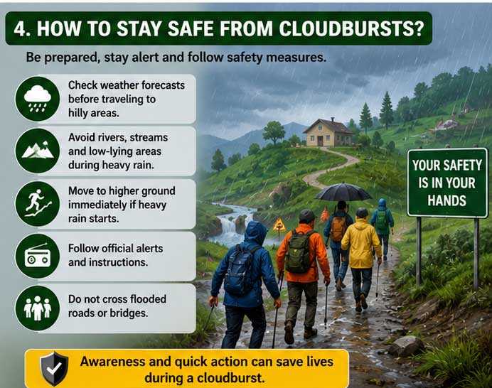
People often search for how to be safe from cloudburst, how to avoid cloudburst, how to protect yourself from cloudburst, and how to save from cloudburst.
Follow these safety guidelines:
Before Traveling
- Check weather forecasts.
- Avoid unnecessary mountain travel during heavy rainfall.
During a Cloudburst
- Move to higher ground immediately.
- Stay away from rivers and streams.
- Avoid bridges.
- Do not attempt to cross flooded roads.
After a Cloudburst
- Follow official instructions.
- Beware of landslides.
- Avoid damaged roads.
If you’re wondering how to escape cloudburst, the most effective strategy is to leave low-lying areas as quickly as possible.
Cloudbursts in Local Languages
Many people search for weather information in regional languages, using phrases such as:
- Why cloudburst happens in Hindi
- How cloud burst in Hindi
- How cloudburst occurs in Hindi
- How cloud burst happens in Urdu
- How cloud burst in Uttarakhand
This growing interest reflects the need for disaster awareness among local communities, especially in vulnerable mountain regions.
Frequently Asked Questions
What is cloudburst and how does it occur?
A cloudburst is an extremely intense rainfall event that occurs when moisture-laden air rapidly condenses and releases large amounts of precipitation over a small area.
How does cloudburst happen?
Cloudbursts develop when warm, humid air rises, cools, condenses, and releases massive amounts of rain within a short period.
What happens when a cloudburst occurs?
What happens when a cloudburst occurs depends on the landscape. Flash floods, landslides, road damage, and river overflow are common consequences.
How dangerous is a cloudburst?
Cloudbursts are extremely dangerous because they can cause sudden flooding and landslides.
How much rainfall occurs during a cloudburst?
Rainfall generally exceeds 100 mm within one hour.
How long does a cloudburst last?
Most cloudbursts last between 15 and 60 minutes.
Can cloudbursts be prevented?
No. Cloudbursts cannot be prevented, but disaster preparedness can significantly reduce their impact.
Understanding what is cloudburst and how does it occur is becoming increasingly important as extreme weather events become more common. Cloudbursts are powerful examples of how quickly atmospheric conditions can change.
Although scientists continue to improve forecasting methods, these events remain difficult to predict. The best defense is awareness, preparedness, and respect for nature’s immense power.